Trip-Planning FAQs
Planning a People-Powered East Coast Adventure?
We’re excited you’re considering it. Below are answers to some of the most common questions we hear from people starting to plan their journeys.
As a small nonprofit, our primary focus is continuing to build and connect the Greenway. While we’re not able to provide individualized trip-planning support, we’re steadily expanding resources to help the growing community of cyclists, runners and walkers explore this one-of-a-kind 3,000-mile route linking 450 communities along the nation’s most populated corridor.
The Basics
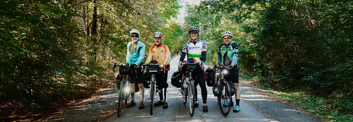
How long does it take to travel the entire East Coast Greenway? By bike, most cyclists will take between two and four months, depending on how many miles a day they want to ride. Walkers of the entire route have taken roughly six months.
How do I navigate the Greenway? You’ll find more information on how to use our online mapping platform here. The online tool allows you to upload files to a navigation app such as Maps.me or Ride with GPS and/or print turn-by-turn cue sheets. Some sections of the Greenway are better marked than others with East Coast Greenway signs and turn arrows, which can serve to confirm that you are on course.
Which direction should I travel, north or south? Choosing which way to travel the East Coast Greenway, especially its entire length, is best decided by the seasons. If you can begin your trip in spring, it’s probably best to head north from Key West, where the temperatures are likely to be warm; by the time you reach Maine it should be warm there, too. Leaving Calais, Maine, our northern end, makes sense for late summer or fall, so that the last 600 miles or so in Florida should be a little temperate by the time you get there.
Where should I stay? We hope to produce an East Coast Greenway guide in the future that will include recommended lodging and camping options near the route. Most Greenway travelers depend on a mix of Airbnb rentals, hotels and warmshowers.org stays. Cyclists and walkers will find some nearby campgrounds in our more rural areas, and many travelers have successfully managed stealth camping — as in asking the local firehouse if you can pitch your tent on their grounds.
What kinds of surfaces should I expect? The East Coast Greenway is a mix of surfaces from asphalt — bike paths and the shoulders of roads — to concrete paths, wooden boardwalks and bridges, stone-dust and natural surfaces to gravel paths. Unpaved sections are indicated on our online mapping platform, map.greenway.org, with a dashed line. Some extended sections, like the Downeast Sunrise Trail in northern Maine, offer an on-road option if travelers find the natural surface too rough.
Can I ride the Greenway on a road bike? A road bike, with thinner tires and lightweight frame, is fine for many sections of the East Coast Greenway, but wider tires, 32-38 mm, will mean a more comfortable ride on all Greenway sections, including those made of stone-dust, gravel and dirt. If you are carrying a substantial amount of gear, you’ll be safer on a heavier touring bike, meant to carry the weight of loaded bags.
How should I train for a 3,000-mile ride? One of the great things about long-distance cycling compared to, say, marathon running, is that to some extent you can train as you go. Cycling doesn’t pound your joints and muscles the way running does. After a few days of discomfort getting used to sitting on a small seat and asking your quads to work every day, most cyclists experience growing stronger each day. That said, it’s of course helpful to build up some miles before you take off (biking or walking). Practice with loaded bike bags or a backpack so that your first day of carrying your gear isn’t such a shock; even better if you can take a trip of a few days or a week before launching your longer trip.
Are there rules and laws about using the East Coast Greenway? The Greenway belongs to each municipality that it passes through, with laws and rules that may vary (for example, hours that the trail is open). See our basic guidelines on safety and etiquette.
Through-Travelers & More Resources
How many people have completed the entire East Coast Greenway? We count more than 120 through-travelers, including a few walkers — and one runner — of the whole route. This list includes cyclists who have completed the Greenway over many years as well as those finishing in one trip. Learn more about our end-to-end Greenway explorers.
How does the East Coast Greenway Alliance define through-traveler? We define a through-traveler as someone who completes the entire route during any period of time, in any particular order.
I may not be ready to tackle the entire East Coast Greenway. Can you recommend some shorter portions of the route? Yes! Check out our list of featured segments and itineraries for many options of varying lengths. The stretch of Greenway between New Haven, Connecticut, and Providence, Rhode Island, makes for an especially enjoyable multi-day ride.
Do you recommend skipping the developing portion of the Greenway between Charleston, South Carolina, and Savannah, Georgia? Currently, our interim route in South Carolina and Georgia, includes a great deal of high-stress, on-road segments, predominantly on U.S. Highway 17. Our team is working with local municipalities and agencies to improve conditions in the region, but we strongly advise against riding these high-stress segments at this time. We recommend long-distance travelers focus on experiencing our beautiful, completed segments of the East Coast Greenway. The Spanish Moss Trail in Beaufort, South Carolina, and West Ashley Greenway south of Charleston are incredible sections of the trail, offering the best shorter rides in the region on the Greenway route. Those still wishing to complete long-distance rides through this region are encouraged to seek vehicle support or travel by Amtrak to bypass this stretch. Most end-to-enders have skipped this section in recent years, and the Alliance has recognized their completion of the full East Coast Greenway route.

Should I tell the East Coast Greenway Alliance that I’m planning to bike or walk the route? We don’t require that you register your trip, but we like to know who is enjoying the Greenway and we are happy to keep an unofficial register of thru-travelers. You can write to us to let you know when you are leaving and whether you are traveling south to north or north to south, then let us know when you finish.
Along the way, if you are active on social media, we love to hear how your trip is going and see your favorite sights, so be sure to tag the East Coast Greenway when you post updates:
Can I support the completion of the East Coast Greenway while embarking on my journey? Our team can help you turn your adventure into a fundraiser! We’ll create a personalized donation page where your friends, family, and followers can contribute directly to the East Coast Greenway Alliance in your honor. Every dollar raised brings us closer to completing this iconic Maine-to-Florida route — making more adventures like yours possible. Ready to get started? Contact John Martin, Senior Director of Marketing & Communications, at john@greenway.org.
Greenway Guidance
While the East Coast Greenway Alliance is constantly improving the safety of the Greenway route through its advocacy efforts, many of the current on-road connections, including those on the Greenway’s interim routes, have little or no special provisions for bicyclists or pedestrians. Long-distance travel via on-road sections of the Greenway is recommended for experienced cyclists only. Many lengthy traffic-free segments of the Greenway are suitable for families and cyclists, walkers and runners of all ages and abilities.
The current on-road routing is housed on low-traffic roads whenever possible. We aim to be as clear as we are able about the conditions riders can expect by including alerts for known stressful sections on our online mapping tool at map.greenway.org as indicated below. Please note that points of caution – indicated by red dots on the map – only appear when zoomed in at the 1-mile scale or closer. You can click on an individual dot to see more caution details.
Directional signage may or may not be present along the route. Users are advised to review state traffic laws, research current road conditions and discuss plans with people familiar with area roadways.
This website provides information for the public about trails and roads for traveling the interim route of the East Coast Greenway and their general suitability for long-distance cycling and walking. The East Coast Greenway Alliance and those involved with the development and publication of this website do not assume any liability for injuries, damage or loss to persons using this information or the routes suggested. People using this information are responsible for their own safety and should take appropriate precautions.