High-Stress Segments
Plan a Safe Greenway Journey
The East Coast Greenway’s current route available at map.greenway.org is an in-development, work-in-progress that connects the completed, traffic-free segments of the Greenway. To date, approximately two-thirds of the Greenway’s interim route remains housed on roadways. Whenever possible, the interim route is located on low-traffic roadways; however, high-stress segments do exist and are outlined below.
These extremely high-stress segments should be avoided by inexperienced long-distance travelers, especially those traveling with children. There are a number of protected, off-road segments that are safe and appropriate for travelers of all ages.
Communicating Current Conditions
The East Coast Greenway Alliance recently made a big step forward in communicating the Greenway’s current conditions as people plan their experience on the interim road travel route that connects the stretches of complete, protected Greenway.
Working in coordination with our long-time partners at Greeninfo Network, we are pleased to share that our online mapping tool at map.greenway.org has been updated to clearly identify high-stress, on-road portions of the interim East Coast Greenway route.
In most cases, when alternatives exist, Alliance team members have indicated any alternate public transit options within the text of the caution dot at the beginning and end of these segments. Unfortunately, for many of these extremely high-stress segments there is also no public transit either. Our staff members work with transportation planning agencies in all regions to help them understand the needs of people walking, bicycling, using wheelchairs and others using non-motorized means of transport.
High-stress segments vary greatly in different regions because the infrastructure varies widely. For example, the segments labeled as high-stress in Maine may not be considered as high-stress as those in South Carolina and Georgia, where vehicle speeds are higher and bicycle and pedestrian facilities are often non-existent. Also, depending on time of day, weather and traffic conditions, ANY on-road section could feel high stress even if it’s not labeled as such.
From north to south, high-stress, on-road segments of the East Coast Greenway interim route include the segments listed below. A link to each section on map.greenway.org also is included for each high-stress segment.
High-Stress Segments by State
Maine
- Bangor: Odlin Road – 2.6 miles
- Biddeford: U.S. 1 / Elm Street – 0.5 miles
Massachusetts
- Peabody: Lowell Street – 0.1 miles
- Fall River/Westport: Martine Street / U.S. Route 6 – 0.5 miles
- Wareham to Bourne: Cranberry Highway / U.S. Route 6 – 0.6 miles
- Cape Cod: Sagamore Bridge – 0.5 miles
New Jersey
- East Riverton: River Road (Google Street View) – 1.7 miles
Pennsylvania
- Bensalem: State Road (Google Street View) – 5.0 miles
- Delaware County: Route 291 (Google Street View) – 4.1 miles
Maryland
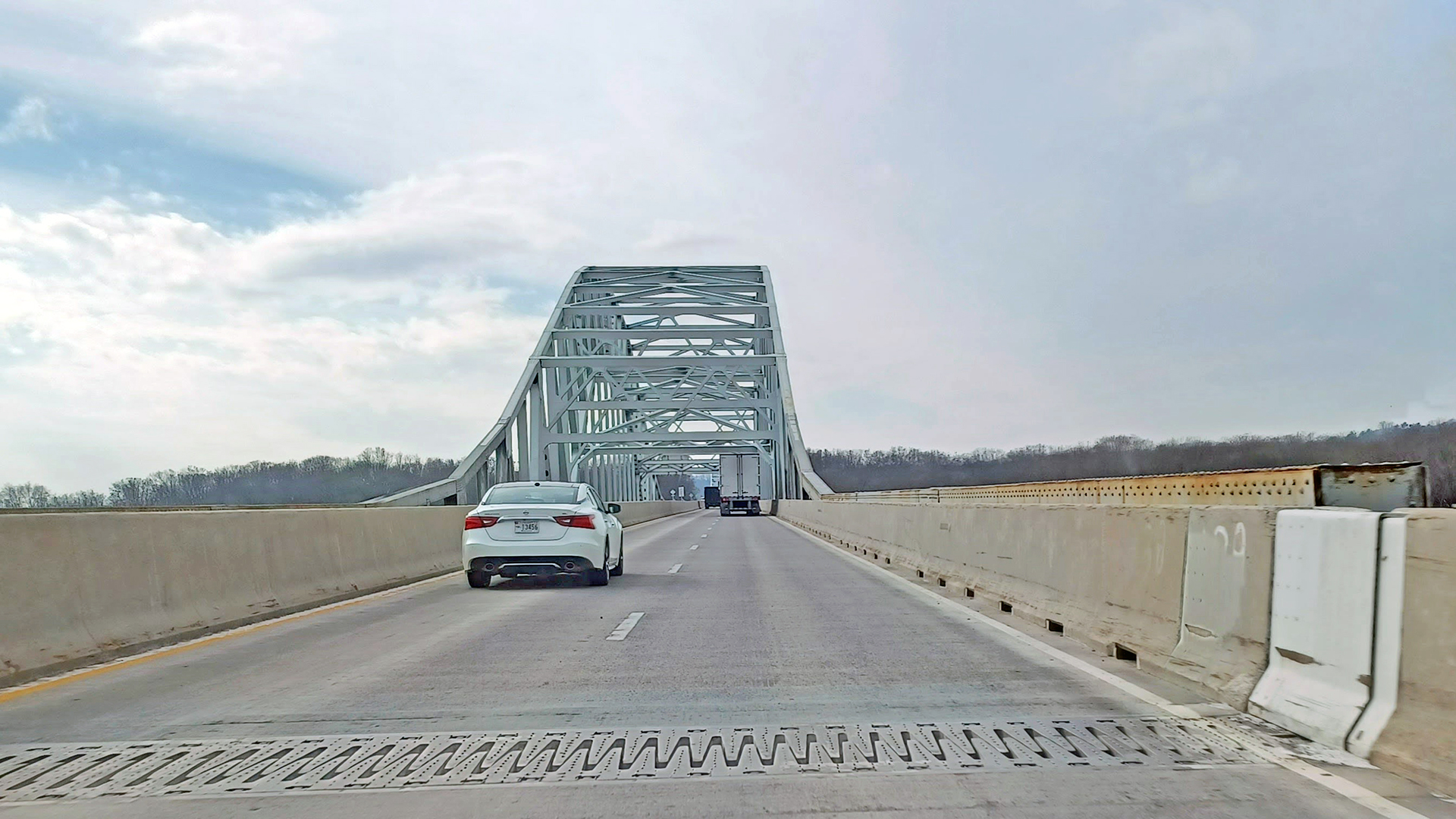
- Susquehanna Crossing between Havre de Grace and Perryville: US-40 / Hatem Bridge (Google Street View, speed limit; Google Street View, open joint) – 2.0 miles
- Hilly area by Jarrettsville and westward from Harford County into Baltimore County: MD-165, MD-23, and MD-138 (Google Street View) – 8.9 miles
Virginia
Multiple sections of U.S. Route 1 listed below:
- Quantico: U.S. Route 1/Richmond Highway between Semper Fidelis Way and Telegraph Road – 3.5 miles
- Stafford: U.S. Route 1/Richmond Highway between Telegraph Road and Bell Hills Road/SR 631 – 2.5 miles
- Doswell and Golansville: U.S. Route 1 – 8 miles (Transit option: Amtrak and Virginia Railway Express between Union Station in Washington, D.C./Alexandria Station and Fredericksburg can be used to skip these sections)
- Chesterfield: Iron Bridge Road between Reservoir Lane and Jessup Road – 1.5 miles (Transit option: Amtrak between Richmond and Petersburg can be used to skip this section)
- Chesapeake: U.S. Route 13/South Military Highway between U.S. 460 and Galberry Road – 2.5 miles
- Chesapeake: U.S. Route 17 between the end of the Dismal Swamp Canal Trail and the North Carolina border – 3.5 miles
North Carolina
Spine (29.1 miles):
Wilmington Bridges:
- Isabel Holmes Bridge over the Cape Fear River – 0.7 miles
- Snow’s Cut Bridge (US-421/North Lake Park Boulevard/Carolina Beach Road/Sea Breeze Bridge) – 1.2 miles
Brunswick County:
- NC-211 (Southport-Supply Road SE)– 15.5 miles
- Highway 421 north of Wilmington – 11.7 miles
Coastal (56.4 miles):
Multiple segments of U.S. Highway 17:
- From Wilmington to Topsail – 13.9 miles
- From Dixon to Jacksonville – 11.4 miles
- Going into and out of Williamston – 5.6 miles
- South of Windsor – 1.5 miles
- West of Edenton – 4.4 miles
- Beside the Dismal Swamp Canal, south of the Virginia line – 3.2 miles
- Highway 55, segment east of New Bern, and heading north from New Bern – 12.2 miles
- U.S. 264 between Greenville and Washington – 4.2 miles
South Carolina & Georgia
Multiple segments of U.S. Highway 17:
- Hardeeville: SC 46 outside Hardeeville
NOTE: 185 miles of the interim travel route in Georgia and South Carolina is high stress. The interim travel route in Georgia and South Carolina totals 437 miles, so more than 40% of the route is high stress.
Florida
- Georgia-Florida border: U.S. 17 bridge with steel grate
- Jupiter: Construction rerouting traffic around U.S. 1 bridge – 2.5 miles (estimated completion in 2026, project details)
- Boynton Beach: A1A section where the shoulder abruptly ends – 1.5 miles
- Entering the Florida Keys: Card Sound Road – 16 miles
Greenway Guidance
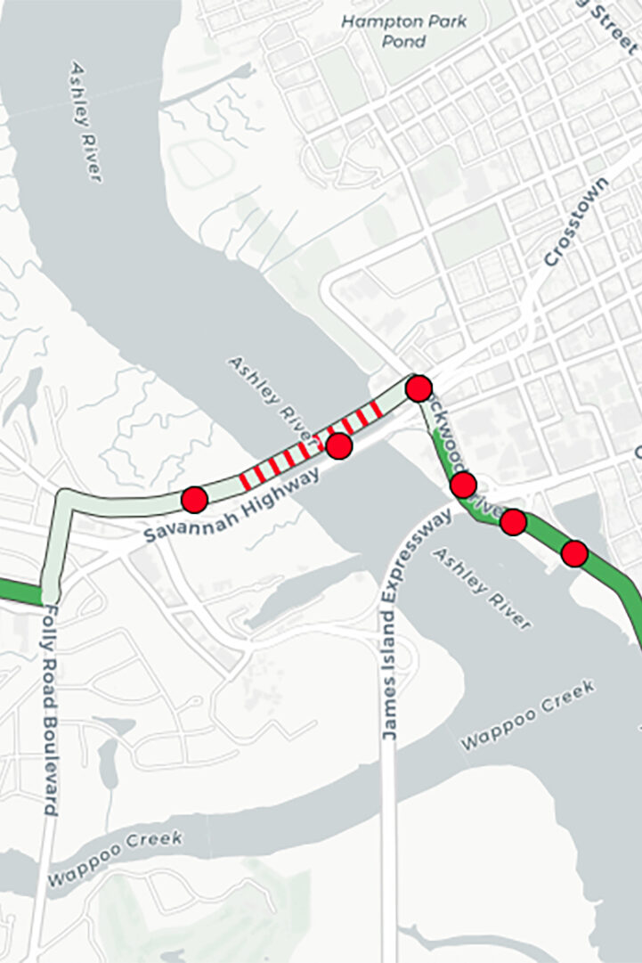
The East Coast Greenway’s interim on-road routing connecting trails and protected infrastructure is housed on low-traffic roads wherever possible. While we work to advocate, plan and design an entirely protected route Maine to Florida, currently, many portions of the on-road routing are on high traffic, high speed roads with limited or no shoulder because there are no other options. We aim to be as clear as we are able about the conditions riders can expect by including “high stress caution” red hatch lines and caution alerts for known stressful sections on our online mapping tool at map.greenway.org as indicated below. Please note that points of caution – indicated by red dots on the map – only appear when zoomed in at the 1-mile scale or closer. You can click on an individual dot to see more caution details.
For more detail on how we determine an extremely high stress segment you can read more here on levels of traffic stress.
Please note that there are still other on-road sections, which, although they are not labeled as high stress, could still be perceived as high stress depending on the comfort and experience level of the individual East Coast Greenway user or based on the non-motorized mode of transportation (e.g., biking, skateboarding, walking, or running). This fact is due to the variety of bike and pedestrian facilities along on-road route segments. In particular, be advised that there are long stretches of the on-road route that do not have sidewalks, bike lanes or shoulders
Additionally, there may still be times, days, or even seasons (i.e. beach corridors) when certain on-road segments can become high stress during specific time periods. With this in mind, it is recommended when possible to avoid traveling during weekday rush hours, Friday and Saturday evenings or other peak usage times. In other cases there may be sporadic spikes in traffic such as detours due to construction or road incidents.
Directional signage may or may not be present along the route. Users are advised to prepare their own navigation with maps and navigational devices as directional signage on route is not yet consistent enough to use for navigational purposes in most regions. Users are advised to review state traffic laws, research current road conditions and discuss plans with people familiar with area roadways and trails.